 3 hours ago
16
3 hours ago
16
After becoming one of the strongest Pacific hurricanes recorded, Polo's circulation will weaken. However, the tropical moisture could travel further north.
Hurricane Polo has already carved out a place in eastern Pacific history.
The compact but extremely powerful hurricane rapidly intensified from a tropical storm into a Category 5 cyclone, eventually reaching maximum sustained winds of 180 mph. That places Polo among the strongest storms, based on minimum pressure, in Pacific hurricane history.
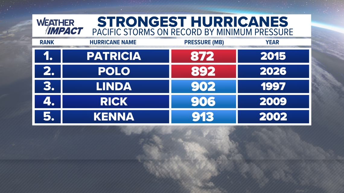
Its immediate threat remains across Western Mexico, where heavy rain could produce dangerous flash flooding and mudslides - even if the storm's center remains offshore. However, what happens after Polo begins weakening could become another important part of the story.
Some long-range computer guidance suggest Polo's remnants or tropical moisture may move across Mexico during the next 10 days, although that possibility remains highly uncertain and extends beyond the National Hurricane Center's official forecast period.
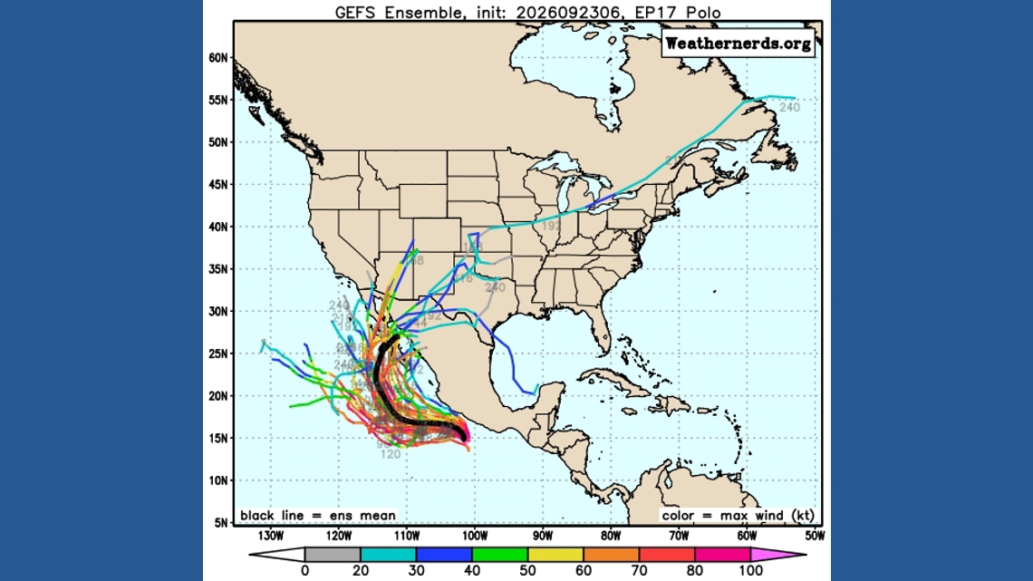
Mexico's rugged mountains would quickly disrupt Polo's circulation, but the storm's deep tropical moisture would not necessarily disappear. If an approaching weather system pulls that moisture northward, it would increase the heavy-rain and flooding potential across parts of the southern and central United States.
Strong El Niño years have produced pieces of this setup before: Paul's remnants reached New Mexico and West Texas in 1982, Pauline caused catastrophic flooding in Mexico in 1997, and Patricia's moisture prompted a major Texas rainfall event in 2015. All strong El Niño years. Some of the latest forecasts continue to put our current El Niño in record warmth territory.
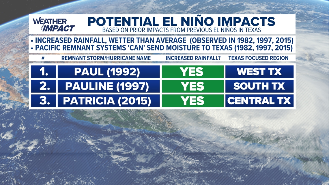
None of those storms guarantees a repeat with Polo, but they demonstrate how a Pacific hurricane's winds can fade while its moisture continues traveling downstream.
Stay up to date with your local forecast and the National Hurricane Center's daily outlooks for the latest information.