 10 hours ago
29
10 hours ago
29
A Gulf disturbance could organize into Tropical Storm Edouard this week. Meanwhile, the remnants of Dolly move closer to Florida. Both could bring heavy rainfall.
WASHINGTON — The potential for Tropical Storm Edouard is taking center stage in the Northern Gulf, as a tropical disturbance referred to as Invest 97L continues to show signs that it could organize into the season's next named storm.
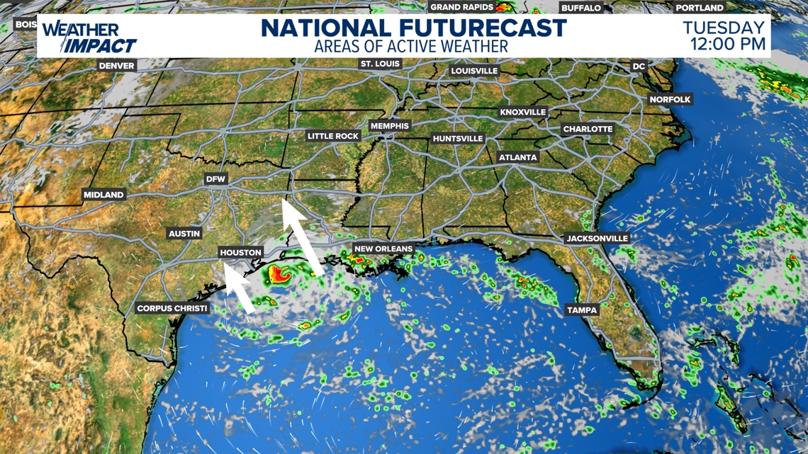
Development remains uncertain as of Sunday afternoon, but latest computer model guidance suggests a tropical low spinning off the Texas coast this week.
If the system can strengthen before moving inland, it could bring periods of heavy rain, gusty winds and a low-end flooding threat from parts of Louisiana into southeast Texas through Tuesday and Wednesday.
Even if Edouard does not fully develop, tropical moisture associated with the disturbance could still lead to unsettled weather and locally heavy rainfall along the northwestern Gulf Coast.
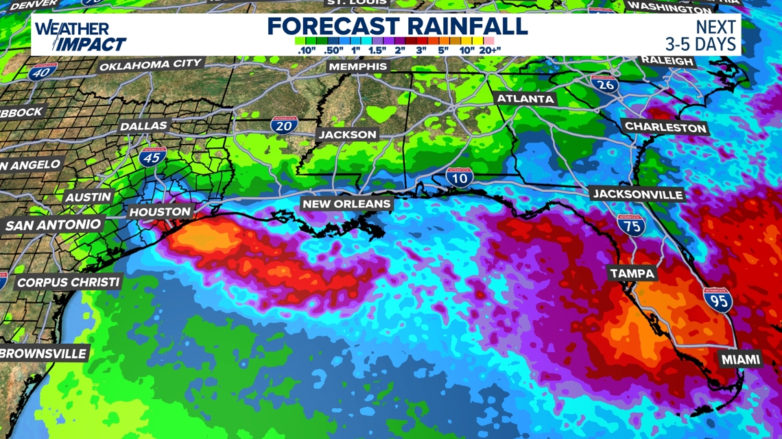
Another tropical trouble spot is also being monitored farther east. The remnants of former Tropical Storm Dolly are moving toward Florida, bringing the potential for increasing tropical moisture and heavy rain later in the week.
The system remains disorganized, but forecasters will be watching for any redevelopment as it approaches the eastern Gulf, where periods of heavy rain could raise the risk of localized flooding, depending on how the system evolves and where the heaviest bands of rain develop.
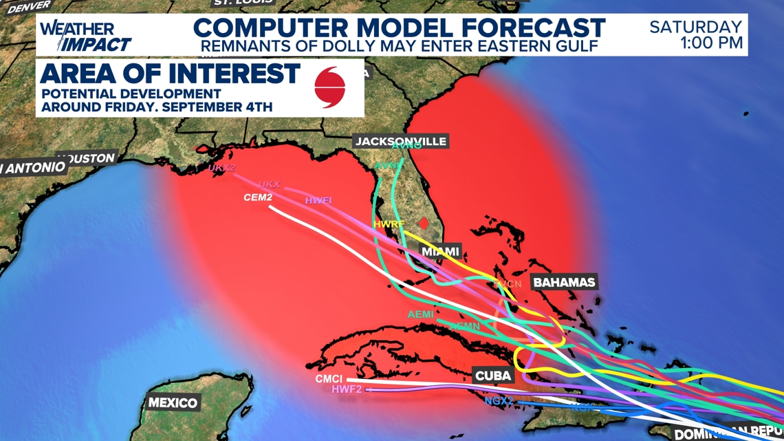
As with any tropical system, conditions and the forecast can change quickly.
Residents along the Gulf Coast should stay up to date with the latest forecast and check in with their local weather team each day for updated information on potential rainfall, flooding and wind impacts.